Alma de Nogal : Los Chalchaleros

miércoles, 23 de agosto de 2023

Cambio climático: cómo era la Tierra cuando había tanto CO2 en la atmósfera como ahora. BBC MUNDO


Cambio climático: cómo era la Tierra cuando había tanto CO2 en la atmósfera como ahora

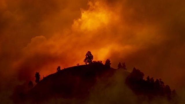
Incendios en Australia

FUENTE DE LA IMAGEN,GETTY IMAGES

"Los datos son desoladores", señala el informe de este martes de Naciones Unidas.

Los países deben quintuplicar sus compromisos de reducción de emisiones de CO2, uno de los principales gases de efecto invernadero, si se quiere evitar un calentamiento mayor de 1,5 grados respecto a la era preindustrial.

Ésa es una de las conclusiones del nuevo informe de ONU-Medio Ambiente sobre "disparidad de emisiones", la comparación entre los niveles actuales de emisiones de gases de invernadero y los niveles admisibles para evitar los efectos más catastróficos del calentamiento global.

Aun si los países cumplieran sus compromisos delineados tras el Acuerdo de París, el mundo va camino a un calentamiento de al menos tres grados si no hay cambios drásticos y se reducen las emisiones en un 7,6% cada año durante la próxima década. La temperatura ya amentó un grado a nivel global respecto a la era preindustrial (cerca del año 1780).

El reporte se suma a otro publicado el lunes por la Organización Meteorológica Mundial (OMM) sobre un nuevo récord en las concentraciones de gases de invernadero en la atmósfera.

Desde la era preindustrial, cuando los niveles de CO2 eran de 228 partes por millón o ppm, las concentraciones promedio alcanzaron en 2018 un nivel de 407,8 ppm. El año anterior el nivel fue de 405,5 ppm.

El secretario general de la OMM, Peteri Taalas, recordó que "la última vez que la Tierra experimentó concentraciones de CO2 comparables a las actuales" fue hace millones de años, cuando el nivel del mar alcanzó niveles que pondrían hoy en peligro a todas las ciudades costeras del planeta.

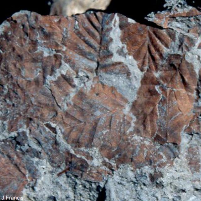
Fósiles de hojas de hayas

FUENTE DE LA IMAGEN,JANE FRANCIS/BAS

Pie de foto,

Estos fósiles de hojas de hayas revelan cómo eran los bosques cerca del Polo Sur durante el Plioceno.

¿Qué lecciones alberga ese pasado geológico para nuestro futuro?

"El mar era 20 metros más alto que ahora"

Las concentraciones de CO2 fueron comparables a las actuales, de unos 400 ppm, "durante el Plioceno, hace entre 5 y 3,5 millones de años aproximadamente", explicó a BBC Mundo Martin Siegert, experto en geofísica y cambio climático de Imperial College en Londres.

No se trató de un momento sino de un proceso de cientos de miles de años, "pero en cierto punto durante el Plioceno la temperatura fue 4 grados centígrados superior a la actual y el nivel del mar llegó a ser 20 metros más alto que ahora".

Fósiles de árboles hallados en la Antártica demuestran que durante el Plioceno había bosques de hayas(Nothofagus beardmorensis) cerca del Polo Sur.

Y se había perdido el hielo en Groenlandia y en gran parte del oeste y este de la Antártica.

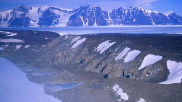
Rocas a 500 km de Polo Sur

FUENTE DE LA IMAGEN,JANE FRANCIS/BAS

Pie de foto,

Estas rocas en las que se hallaron fósiles de árboles del Plioceno están a solo 500 km del Polo Sur.

Pero las concentraciones del Plioceno representaron una reducción de un nivel mucho mayor.

Siegert señaló que hace 55 millones de años las concentraciones de CO2 alcanzaron más de 1000 partes por millón, lo que fue producto fundamentalmente de gases emitidos por la actividad volcánica.

A partir de ese momento el carbono en la atmósfera comenzó a bajar a lo largo de millones de años debido a procesos naturales, lo que explica por qué en la era preindustrial los niveles eran de 280 ppm.

La reducción se debió a que el carbono en la atmósfera fue extraído gradualmente por plantas y animales, y luego enterrado.

"Los organismos marinos que mueren caen al fondo del mar y son enterrados con el carbono que contienen. Recordemos que todos los árboles formaron depósitos de carbón y los organismos marinos formaron reservas de petróleo y gas", afirmó Siegert.

"Y lo que hemos estado haciendo en los últimos 150 años es excavar todo el carbono y ponerlo en la atmósfera. Es una locura".

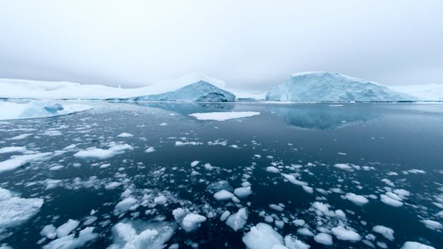
Antárctica

FUENTE DE LA IMAGEN,GETTY IMAGES

Pie de foto,

El mar durante el Plioceno llegó a tener 20 metros más de altura que en la actualidad.

"Esto nunca pasó antes"

El Plioceno, con sus concentraciones de CO2 similares a las actuales, podría ofrecer una analogía útil para entender los cambios que la acción humana está forzando en el planeta.

Pero hay un aspecto en el que los niveles actuales de CO2 no tienen precedente, de acuerdo a Siegert.

Cuando hace 55 millones de años los niveles de CO2 pasaron de unas 300 ppm a cerca de 1000 ppm debido a la actividad volcánica, eso sucedió en un período de unos 20.000 años.

Siegert advirtió que "si seguimos quemando combustibles fósiles al ritmo que lo hacemos ahora, llegaremos a 1000 ppm a fin de este siglo. Esto significa que lo que le llevó a la Tierra 20 mil años antes, nosotros lo haremos en 80".

"Por eso digo que estamos ante una verdadera emergencia climática", agregó el experto de Imperial College.

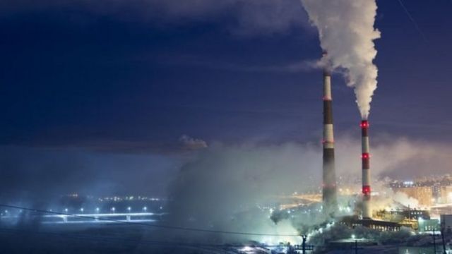
Planta que emite dióxido de carbono

FUENTE DE LA IMAGEN,GETTY IMAGES

Pie de foto,

La ONU advirtió que las emisiones de gases de efecto invernadero deben reducirse un 7,6% cada año durante la próxima década.

"No tenemos una analogía para el ritmo de cambio que estamos viendo ahora, esto nunca pasó antes en la historia de la Tierra".

COP25

La próxima semana representantes de cerca de 200 países se reunirán en Madrid en la nueva cumbre anual de cambio climático, la conferencia de las partes o COP25.

El mensaje que esos delegados y todos debemos tener presente tras el nuevo informe de la ONU es que "el problema es urgente y las naciones deben enfocarse en qué van a hacer el respecto", señaló a BBC Mundo Chris Rapley, exdirector del Instituto Antártico Británico y profesor de ciencia climática de University College London.

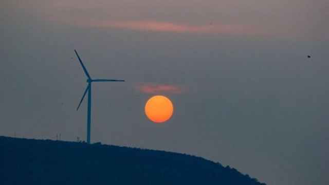
Torre de energía eólica

FUENTE DE LA IMAGEN,GETTY IMAGES

Pie de foto,

Los países deben quintuplicar sus compromisos de reducción de emisiones para evitar un calentamiento mayor de 1,5 grados.

"Desafortunadamente, con inundaciones, incendios, olas de calor y tormentas intensas, vemos cómo los impactos del cambio climático se están acelerando más de lo que esperábamos hace unos años".

"Les doy un ejemplo, el satélite Jason 3 que midió durante 10 años los cambios en el nivel de los océanos y acaba de llegar a su vida útil, midió solamente en esa década un aumento global de cerca de 4 cm".

Rapley señala que, además de la acción de los gobiernos, se necesita que cada persona reflexione sobre qué puede hacer.

Para algunos será comer menos carne, para otros dejar de invertir dinero en instituciones que financian combustibles fósiles, votar por candidatos que lidien con el cambio climático o usar transporte público.

Según el científico británico, "cada uno de nosotros debe pensar en una cosa grande que podría hacer y hacerla".

Para Siegert, "cuanto más tardemos en actuar más difícil y más caro será hallar soluciones".

lunes, 21 de agosto de 2023

Himachal Pradesh floods: More rain, less snow are turning Himalayas dangerous. BBC


Himachal Pradesh floods: 

More rain, less snow are turning Himalayas dangerous

  • Published
Houses damaged by landslide in Pipalkoti village in Chamoli district in Uttarakhand
Image caption,
Increased rain and melting of snow and ice has made the mountain regions more dangerous, a new study finds

Torrential rains and unabated construction are frequently triggering disasters in India's Himalayan region.

But an unusual increase in rainfall is making the terrain even more dangerous.

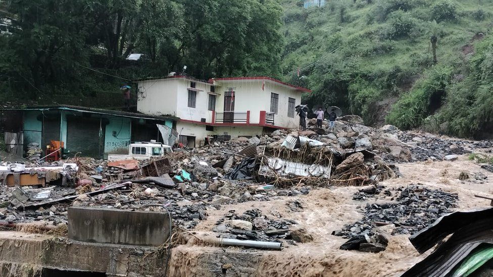
Landslides and flash floods have already killed dozens in the area this month, burying homes and buildings. Parts of Nepal and Pakistan have also suffered damage.

A new study has found that mountains across the globe, including the Himalayas, are now seeing more rainfall at elevations where it has mostly snowed in the past.

The change has made the mountains more dangerous, scientists say, as increased temperatures not only bring rain but also accelerate melting of snow and ice. The rainwater also loosens the soil resulting in landslides, rockfalls, floods and debris-flows.

"Our findings provide several lines of evidence demonstrating a warming-induced amplification of rainfall extremes at high altitudes, specifically in snow-dominated regions of the Northern Hemisphere," says the study, published in June in the Nature journal.

The finding is consistent with a special report of the Intergovernmental Panel on Climate Change (IPCC) in 2019 which said that snowfall had decreased, at least in part because of higher temperatures, especially at lower elevations of mountain regions.

There are more instances of extreme precipitation events occurring now in the form of rainfall even at a high elevation and in all seasons, says Samuel Morin, executive director of the National Centre for Meteorological Research in France and one of the authors of the special IPCC report.

This is mainly because the zero-degree isotherm, the freezing level at which precipitation falls as snow, has moved to a higher elevation because of global warming

"As a result, these [mountain] regions are regarded as hotspots that are vulnerable to high risk of extreme rainfall events and related hazards of flooding, landslides and soil erosion," the study says.

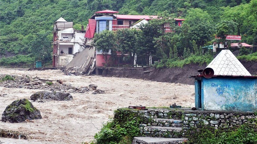
A portion of college building is seen collapsed along the river Maldevta after heavy rains in Dehradun on August 14, 2023IMAGE SOURCE,
GETTY IMAGES
Image caption,
Himalayan states in India have suffered from increased frequency and intensity of landslides and floods

This risk is higher for the Himalayan region compared with other mountainous regions like the Alps and the Rockies in the northern hemisphere, Mohamed Ombadi, the study's lead author, told the BBC.

"That's because there are additional warming-related processes [in the Himalayas] that change wind patterns and storm tracks, leading to an increase in the intensity of storms."

Mountains in the Himalayas, which span India, Bhutan Nepal and Pakistan, hardly have any weather stations, which often leads to a lack of accurate data on precipitation levels.

There are a few stations located in the lower elevations of the mountains but they do not show whether the precipitation recorded is rain or snowfall.

However, a weather station installed at the base camp of Mount Everest showed that 75% of the 245.5mm precipitation on the mountain between 1 June and 10 August this year had fallen as rain. The remaining was snow or a combination of rain and snow.

This is a huge jump from the 32% of rain recorded between June and September in 2022, 43% in 2021 and 41% in 2020.

"We believe the dominance of rain vs snow is a relatively recent phenomenon but do not have longer term data to fully quantify that," said National Geographic explorers Baker Perry and Tom Matthews who were part of the National Geographic and Rolex Perpetual Planet Expeditions that installed the station.

The changes in precipitation are evident on the mountains of the Himalayan state of Uttarakhand, says Bikram Singh, head of the regional weather office.

"We can definitely say snowfall frequency has decreased and this is usually at elevations below 6,000m. During monsoon, the lower elevations receive heavy rainfall."

The dwindling snowfall and increased rainfall mean that the nature of rivers in the region has changed, says Professor JS Rawat, former head of Kumaun University's geography department.

"There are now lots of flash floods after extreme rainfall and rivers that were once glacier-fed in the region have now turned into rain-fed [water bodies]."

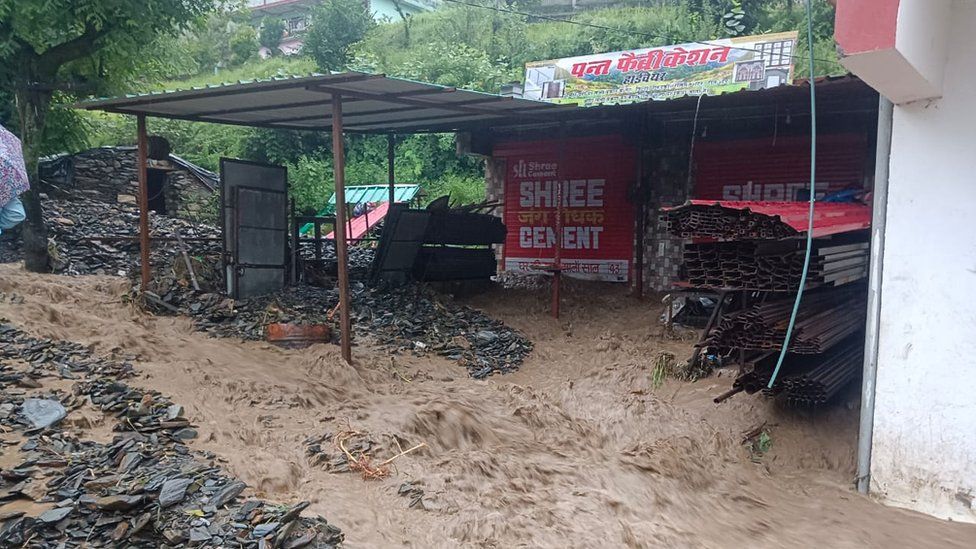
Water gushes by a shed and building in Pipalkoti village in Chamoli district in Uttarakhand
Image caption,
Dozens have been killed in landslides and flash floods in Uttarakhand and Himachal Pradesh this month

Rising temperatures have added to the problem as they have accelerated the melting of Himalayan glaciers. This leads to rapid filling up of glacial lakes that then become prone to overflowing and causing floods. The thinning of glaciers also destabilises mountain slopes.

The Himalayas are estimated to be warming at three times the rate of the global average - and several studies have projected this will lead to substantive increase in rainfall there.

Locals in the states of Uttarakhand and Himachal Pradesh say they have noticed that the frequency and intensity of landslides and floods during the monsoon season have increased.

"Our village Ganai was already threatened by landslides because of increased rainfall on the mountains, so we had to abandon it and move," says Prabhakar Bhatta, 25, a resident of Mayapur village in Uttarakhand's Chamoli district. "But even here we have become homeless."

On 14 August, a little before midnight, a huge flash flood hit Mr Bhatta's two-storey house, burying it under debris of rock, silt and mud.

"We managed to survive because we were warned by people in villages at higher elevations that it was raining very heavily and there could be a flash flood coming our way," he says.

Mr Bhatta says his family stayed up that night and fled when they heard "odd sounds".

"My father built the house with his lifetime savings, and now that too is gone," he says. "This region is becoming unliveable."

A family tries to seal the cracks in their house with mud
Image caption,
Locals say the region has become uninhabitable

Experts say that rampant development of infrastructure like road, tunnels and hydropower projects in the ecologically sensitive region also leads to these disasters. Located in a seismic zone as the Himalayas are, they are subject to earthquakes which make matters worse.

The impact of increased rainfall is also visible across the Indian border.

In northern Pakistan, where the Himalayas meet Karakoram and Hindukush mountains, debris flows and flash floods have become increasingly common, officials say.

There were 120 flash floods in the region's Gilgit Baltistan area during the last monsoon - a huge jump from 10-20 years ago, says Kamal Qamar, director general of the regional disaster management authority.

"It's raining in high altitudes at around 4,000m both in summer and winter, when it should have snowed," he says.

In the eastern Himalayas in Nepal, flash floods and debris flows are destroying vital infrastructure like hydropower and drinking water plants, apart from local settlements, roads and bridges.

According to the country's Independent Power Producers Association, 30 hydropower plants have been damaged in eastern Nepal this monsoon.

Experts say cascading events on Himalayan regions' mountains are also becoming frequent and intense.

That's when an event triggers something else further downstream, says Jakob Steiner, a researcher with the International Centre for Integrated Mountain Development, based in Kathmandu.

"And higher rainfall intensity is often the start or a sub-trigger in these chains."

BBC News India is now on YouTube. Click here to subscribe and watch our documentaries, explainers and features.

Presentational grey line

Read more India stories from the BBC: